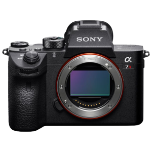
The Sony A7R iv is a full-frame mirrorless camera that incorporates a 61MP stabilized CMOS sensor.
Full frame (36 x 24mm)
9504 x 6336 max resolution
61 MP sensor
24mm or 35mm lens options
GSD as low as 0.6cm/px
ISO 100 ~ 32000
Sony 24mm/35mm E-mount Lens
These wide angle prime lenses in a small form factor are utilized with the Sony A7R camera bodies.
F2.8 ~ F22
Carl Zeiss optics for superior image quality
35mm full frame
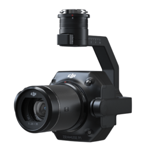
Zenmuse P1
Utilized on the M350RTK platform, the P1 is routinely used for photogrammetry and wind turbine inspections. This camera is renowned for it’s excellent image quality.
35.9 x 24mm Full frame
45MP
-20°C to +40°C temperature range
Various lens options (24, 35, 50mm)
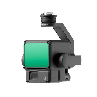
Zenmuse L2 LiDAR
Utilized on the M350RTK platform, the L2 is an integrated geospatial data acquisition payload that combines both a high accuracy LiDAR sensor wand a 4/3 CMOS mapping camera
4/3 CMOS sensor
20MP
High accuracy IMU
LiDAR accuracies to within 5cm
Up to 5 returns guaranteeing excellent penetration.
-20°C to +40°C temperature range
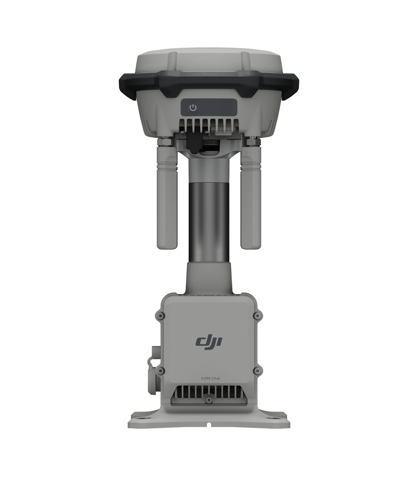
DJI D-RTK 3
The DJI D-RTK 3 Multifunctional Station is a professional-grade, high-precision GNSS positioning solution designed to deliver centimeter-level accuracy for enterprise drone fleets. Engineered for versatility, it operates in three flexible modes—Base Station, Rover Station, or Relay Station—allowing operators to broadcast real-time RTK corrections, map precise ground control points, or drastically extend transmission range in obstructed environments like deep valleys and dense urban corridors.
Centimeter-level positioning accuracy for high-fidelity mapping and 3D modeling
Versatile 3-in-1 functionality (Base Station, Rover Station, and Relay Station modes)
Up to 25km operational coverage extension when deployed in Relay Station Mode
Supports simultaneous RTK differential data broadcasting to multiple drones (1+N mode)
Rugged, field-ready IP67 weather-protection rating against dust and heavy rain
Integrated high-performance IMU for precise device position and orientation analysis
Seamless compatibility with DJI Pilot 2, DJI Terra, and DJI Enterprise drone ecosystems
Records raw observation data in .OBS and .MRK formats natively optimized for third-party PPK software
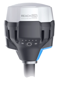
Emlid Reach RS2+
Multi-band RTK/PPK GNSS receiver with centimeter precision. This sensor is utilized for our PPK processing with our DeltaQuad mapping platform
LTE modem
Baseline up to 100KM
PPP support for absolute accuracy
IP67 ingress protection
PPK accuracies: H:5mm V: 10mm
-20°C to +65°C temperature range
DJI D-RTK2 Base station
The D-RTK2 Mobile Station is DJI’s upgraded, high-precision GNSS receiver providing real-time differential corrections for centimeter-level positioning accuracy
Utilized on both the M350RTK & Mavic 3E platforms and to shoot Ground Control Points
Supports GPS, GLONASS, BeiDou & Galileo systems
Quick set-up and seamless integration into DJI airframes